
Norway
Northern lights in Lofoten
25 viewing spots around Lofoten, chosen for a dark sky and an open view. For each one: how dark it is, which way it looks, where to park and how to get there. Under the auroral oval: aurora can be overhead even on quiet nights.
- Viewing spots
- 25
- Dark or very dark
- 15
- Magnetic latitude
- 65.9°
- Clearest dark month
- September 38 % of hours clear or partly clear
Which of these spots is clear tonight, and when? Aurora Atlas scores every spot hour by hour from the cloud forecast, darkness, the moon and live aurora activity, with live camera stills and road notices.
See tonight's live scores for Lofoten in Aurora AtlasViewing spots
-
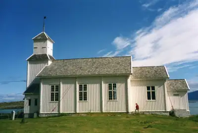 Gimsøysand · Gimsøy church
Tiny settlement by the old church on the flat, thinly populated island of Gimsøya, with open shore and marsh to the…
Gimsøysand · Gimsøy church
Tiny settlement by the old church on the flat, thinly populated island of Gimsøya, with open shore and marsh to the…
-
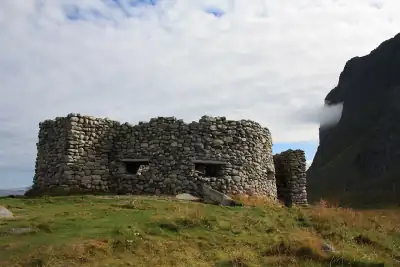 Eggum rest area
Norwegian Scenic Route rest area in an old fishing hamlet on the ocean side of Vestvågøy, with nothing but sea between…
Eggum rest area
Norwegian Scenic Route rest area in an old fishing hamlet on the ocean side of Vestvågøy, with nothing but sea between…
-
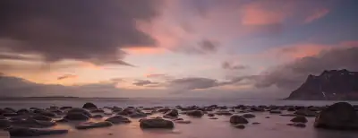 Uttakleiv beach
Boulder beach on the north side of Vestvågøy, one of Lofoten's most photographed aurora spots; the narrow access road…
Uttakleiv beach
Boulder beach on the north side of Vestvågøy, one of Lofoten's most photographed aurora spots; the narrow access road…
-
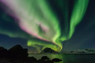 Skagsanden beach
Sandy beach beside the E10 near Flakstad whose north-facing bay gives a broad sky between the mountains.
Skagsanden beach
Sandy beach beside the E10 near Flakstad whose north-facing bay gives a broad sky between the mountains.
-
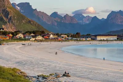 Rambergstranda
Long white beach and Scenic Route rest area at Ramberg on Flakstadøya, right on the E10.
Rambergstranda
Long white beach and Scenic Route rest area at Ramberg on Flakstadøya, right on the E10.
-
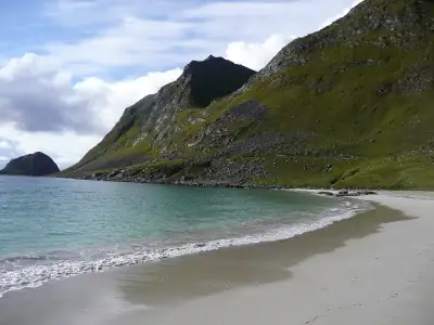 Hauklandstranda
Norwegian Scenic Route rest area at a sheltered sandy beach with a large car park, toilets open all year and a café…
Hauklandstranda
Norwegian Scenic Route rest area at a sheltered sandy beach with a large car park, toilets open all year and a café…
-
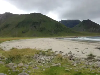 Unstad beach
Arctic surf beach at the end of the road on Vestvågøy's outer coast, facing the open northern sea between steep valley…
Unstad beach
Arctic surf beach at the end of the road on Vestvågøy's outer coast, facing the open northern sea between steep valley…
- Storsandnes beach · Flakstadøya White-sand beach on the quiet north side of Flakstadøya off the Myrland road; part of the 'easy-to-access roadside…
-
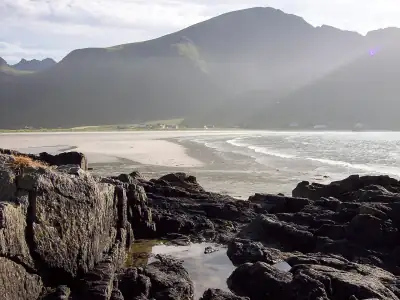 Yttersand (Ytresand) beach · Fredvang
Long sandy beach on the outer side of Moskenesøya past the Fredvang bridges, facing the open sea to the north-west; a…
Yttersand (Ytresand) beach · Fredvang
Long sandy beach on the outer side of Moskenesøya past the Fredvang bridges, facing the open sea to the north-west; a…
-
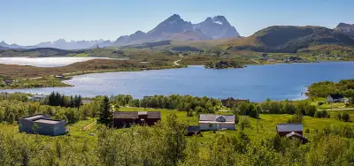 Torvdalshalsen rest area
Norwegian Scenic Route rest area on a hilltop south of Torvdalsvatnet with a long wind screen and benches; toilets…
Torvdalshalsen rest area
Norwegian Scenic Route rest area on a hilltop south of Torvdalsvatnet with a long wind screen and benches; toilets…
-
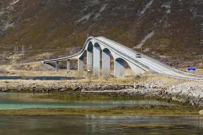 Gimsøystraumen rest area
Norwegian Scenic Route rest area beside the bridge between Austvågøy and Gimsøy, toilets open all year; a reliable…
Gimsøystraumen rest area
Norwegian Scenic Route rest area beside the bridge between Austvågøy and Gimsøy, toilets open all year; a reliable…
-
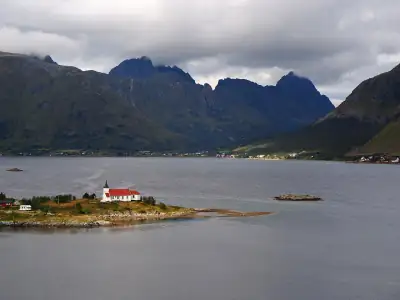 Austnesfjorden rest area · Sildpollnes chapel view
Norwegian Scenic Route rest area on a promontory with a raised walkway looking across Sildpollen to the Sildpollnes…
Austnesfjorden rest area · Sildpollnes chapel view
Norwegian Scenic Route rest area on a promontory with a raised walkway looking across Sildpollen to the Sildpollnes…
-
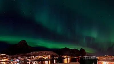 Reinehalsen viewpoint · Reine
Norwegian Scenic Route viewpoint at the foot of Reinebringen, 'one of Norway's most photographed spots': aurora above…
Reinehalsen viewpoint · Reine
Norwegian Scenic Route viewpoint at the foot of Reinebringen, 'one of Norway's most photographed spots': aurora above…
- Haverringen rest area · Vestersand Small Statens vegvesen rest area at Vestersand on the north coast of Vestvågøy: the same open-ocean northern horizon…
- Napp · Nappstraumen car park Car park by the E10 at Napp, where the strait between Flakstadøya and Vestvågøy opens north to the sea: a quick stop…
- Laukvik · Austvågøy north coast Fishing village on the north side of Austvågøy that faces the open sea to the north-west, long known locally as an…
-
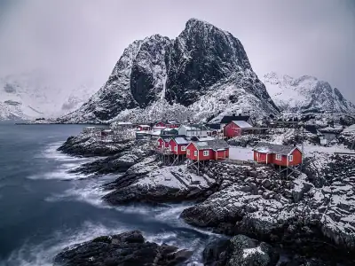 Hamnøy bridge rest area
Small rest area by the Hamnøy bridge, the classic Lofoten aurora-photo view of red cabins and steep peaks. Very busy…
Hamnøy bridge rest area
Small rest area by the Hamnøy bridge, the classic Lofoten aurora-photo view of red cabins and steep peaks. Very busy…
-
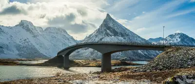 Fredvang rest area · Flakstad
Main rest area with toilets on Strandveien (Fv7708) in Fredvang, Flakstadøya, close to the north-facing beaches.
Fredvang rest area · Flakstad
Main rest area with toilets on Strandveien (Fv7708) in Fredvang, Flakstadøya, close to the north-facing beaches.
-
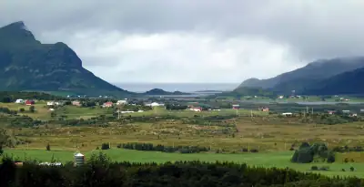 Hagskaret rest area · Fv815
Main rest area with toilets and picnic site on Hagskarveien (Fv815) above Leknes, Vestvågøy.
Hagskaret rest area · Fv815
Main rest area with toilets and picnic site on Hagskarveien (Fv815) above Leknes, Vestvågøy.
-
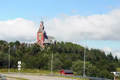 Klokkarvika car park · Gravdal
Public car park with an information board at Klokkarvika on Buksnesveien (Fv818), Gravdal, with toilets (fee) and a…
Klokkarvika car park · Gravdal
Public car park with an information board at Klokkarvika on Buksnesveien (Fv818), Gravdal, with toilets (fee) and a…
- Grunnfør rest stop Scenic Route stop on the quiet outer coast of Austvågøy between Laukvik and Fiskebøl: a cyclists' shelter and a small…
-
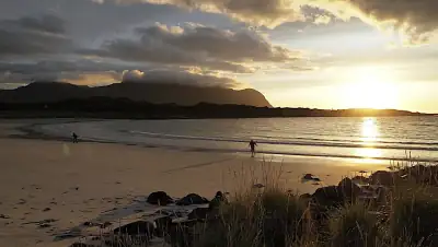 Hov beach · Gimsøy
White-sand beach at the northern tip of flat, thinly populated Gimsøy, beside Hov farm and its campsite; the open sea…
Hov beach · Gimsøy
White-sand beach at the northern tip of flat, thinly populated Gimsøy, beside Hov farm and its campsite; the open sea…
-
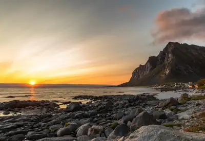 Vikten beach
Beach on the wild ocean side of Flakstadøya, just south of the small glassblowing hamlet of Vikten near the end of the…
Vikten beach
Beach on the wild ocean side of Flakstadøya, just south of the small glassblowing hamlet of Vikten near the end of the…
-
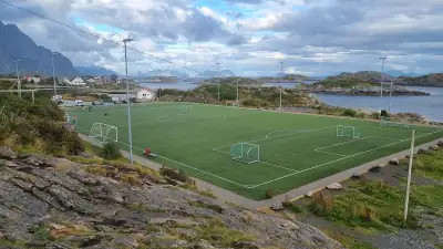 Henningsvær football pitch
The famous football pitch on Henningsvær's outermost island, a short walk from the village: the no-car choice if you…
Henningsvær football pitch
The famous football pitch on Henningsvær's outermost island, a short walk from the village: the no-car choice if you…
- Hattneset rest area · Fiskebøl Small roadside rest area with picnic tables on a point at the mouth of Higravfjorden, just south of the Melbu ferry…
Drive times are estimates from the middle of Lofoten by straight-line distance, as the app estimates them before it knows your route; ferries and winter closures are not counted.
All 25 spots, A to Z
H
Good to know in Lofoten
- Use official parking and stay off private land Visit Lofoten asks visitors to park only in official areas, pull fully off the road, keep headlights and torches away from homes, stay off private land, and check the rules before flying a drone. Source
- The famous beaches charge for parking Haukland and Uttakleiv both have paid car parks. Haukland charges by the hour, with the first 20 minutes free and a 16-hour maximum; Uttakleiv uses automatic number-plate payment. Source
- Check the E10 before driving Storms can close stretches of road in Lofoten. Statens vegvesen's traffic map shows closures, road conditions and road cameras along the E10. Source
- Expect cloud and chase the gaps In December to February, Lofoten is overcast or mostly cloudy about three quarters of the time. Clear gaps drift along the islands, so check the cloud forecast and be ready to drive east or west. Source
- From Svolvær, the open northern sky is 30–40 minutes away The mountains around Svolvær block the north, so staying in town and looking up is a weak bet. The nearest open northern sky is 30 to 40 minutes by car, on Gimsøy or at Fiskebøl. Source